2027
Blauwe Long (Blue Lung)
About 50 boats of sailors who are out a lot, one full season on the North Sea coast, Wadden Sea, IJsselmeer, Markermeer and Zeeland. The first real fleet. We're looking for funding.
Stichting Project SeaSense
Yachts already carry instruments for wind, depth and water temperature, and that data disappears. We collect it, add what science needs, and build an observing network from boats that are already out there.
 Endorsed by the UN Ocean DecadeProject SeaSense is an endorsed Decade Project of the UN Decade of Ocean Science for Sustainable Development (2021–2030). (opens in new tab)
Fixed stations measure one spot. Research ships are scarce. Satellites struggle near the shore. Meanwhile thousands of sailboats cross these waters every year, already carrying instruments. We want every one of them to count.
It plugs into the boat's instrument network, only listens, and adds its own air-pressure and motion sensors.
Readings are stored on board and uploaded whenever there's a connection. The sailor just sails.
We track every instrument and check boats against reference stations and each other, so the data comes with known quality.
Tier 1 is the node. Tier 2 is an optional water-quality module (conductivity, pH, oxygen) for boats that want to go further.
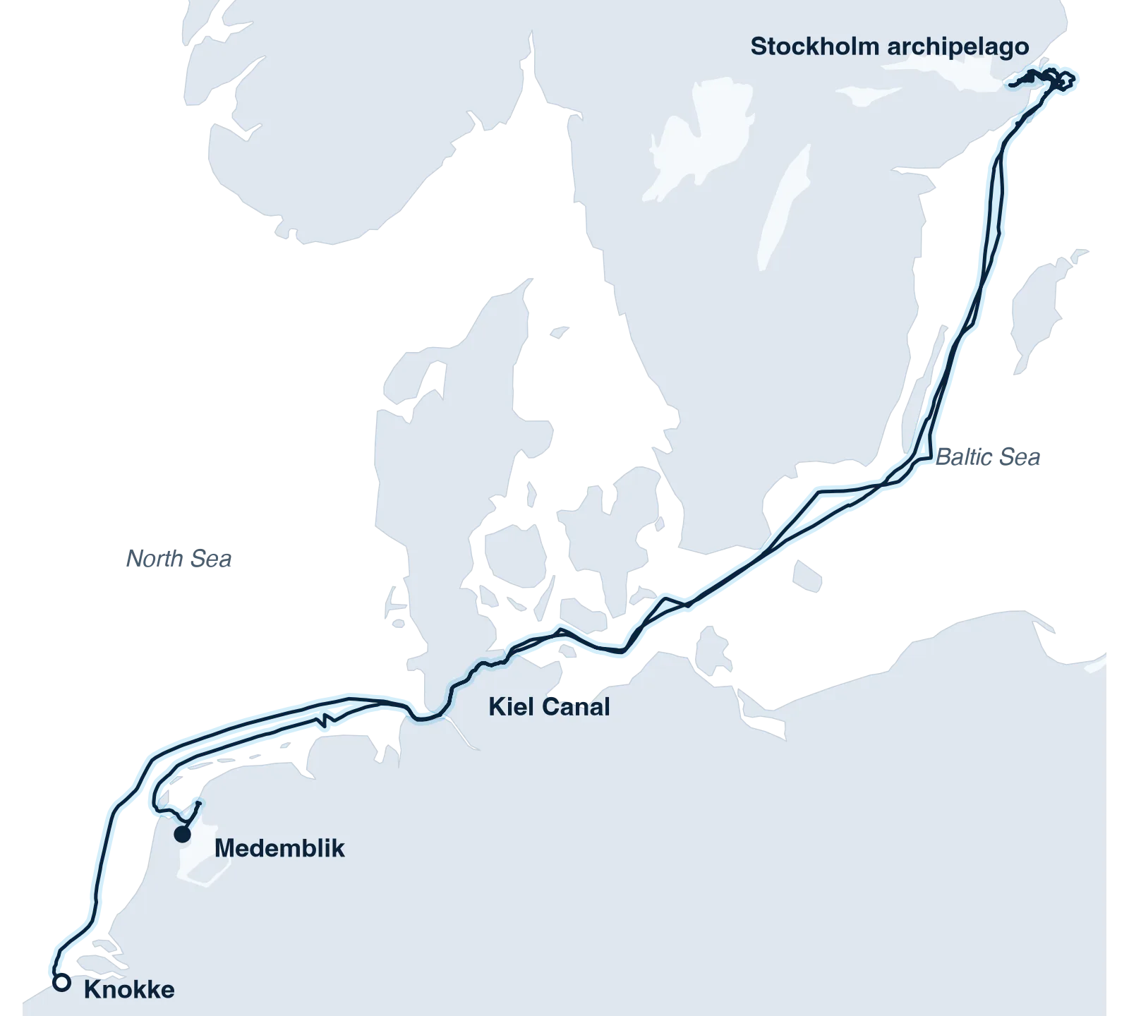
Our first voyage at sea: from the IJsselmeer through the Kiel Canal to the Stockholm archipelago and back to Belgium, summer 2026.
Aboard a new Contest 63CS, made possible by the Naiad Foundation.
Short version: the idea works at sea. Now it needs more boats.
Air pressure
Ready
Weather-station quality.
Depth and water temperature
Ready
Usable, especially in shallow coastal water.
Water quality
In development
Salinity and pH pick up real gradients; the probes don't yet last at sea, and oxygen isn't there yet.
Wind
In development
Collected, but not yet good enough under sail.
Our aim: a coastal observing network made of the boats that are already sailing. Dense enough to calibrate itself, open for science, and funded so it lasts.
2027
About 50 boats of sailors who are out a lot, one full season on the North Sea coast, Wadden Sea, IJsselmeer, Markermeer and Zeeland. The first real fleet. We're looking for funding.
2028
Nodes on charter boats in Croatia, Greece and Turkey, planned with Velamari as part of its fleet service, with the data shared with SeaSense.
2027+
More voyages and hosts beyond the Netherlands, so each new region starts with boats already signed up.
Host a node on your boat, wherever you sail. Nothing to do once it's installed.
Use the data, and help shape what we measure and where.
Help put the first fleet on the water. We're a registered Dutch charity (ANBI).
Back a coastal observing network that's being built right now.
Contest Yachts (opens in new tab)
Co-hosted Expedition 2026 and supported the installation
“At Contest Yachts, we build yachts for sailors who explore the world: 'Building dreams together'. We believe that exploring also means understanding and caring for the oceans we travel.”
PredictWind (opens in new tab)
Sponsor
“As a former America's Cup sailor and founder of a weather-tech company, I know how valuable accurate data is for understanding the ocean. SeaSense empowers sailors to collect data that helps scientists track changes in marine ecosystems.”
Data platform and cloud infrastructure
“At Aknostic, we believe technology should enable independence and sustainability—values that perfectly align with SeaSense's mission to democratize ocean science.”
Partner: fleet monitoring for charter operators
Every charter boat Velamari monitors also measures the sea. Its devices share environmental data with Project SeaSense.
Our MetroSea 2026 paper is co-authored with researchers from The Hague University of Applied Sciences (THUAS) and TNO.