Citizen Science Ocean Monitoring —
Sail with Purpose.
Join our global network of sailors deploying low-cost sensor buoys to help scientists monitor ocean health, track climate change, and detect pollution patterns.

About Project SeaSense
Project SeaSense is an innovative climate initiative that combines sailing and citizen science to monitor our oceans. We're creating a global network of ocean sensors by equipping sailors with sophisticated monitoring buoys that collect vital data to support scientific research and environmental protection.
Read Our Full StoryFor Sailors
Our simple three-step process makes it easy for sailors to contribute to vital ocean research while enjoying their time at sea.
Request your SeaSense unit
Sign up to receive your low-cost, maintenance-free sensor unit that's designed to be easily mounted on your boat.
Take it on your voyages
The compact unit temporarily mounts to your boat and collects data without affecting your sailing performance or experience.
Contribute to global research
Your unit automatically transmits data to our network, helping scientists gather crucial information about our oceans.
For Scientists & Researchers
Access comprehensive ocean data from a growing network of sailor-deployed sensors.
What can the unit measure?
Our advanced sensor units can collect crucial data from both water and air, such as:
- Water temperature
- Water salinity
- Dissolved Oxygen
- pH
- Air temperature
- Air pressure
- Humidity
- ... and more!
[
  {
    "device_guid": "550e8400-e29b-41d4-a716-446655440000",
    "device_version": "1.0.0",
    "epoch": 1772974779,
    "timestamp": "2026-03-08T12:59:39.408Z",
    "lat": 41.0082,
    "lon": -23.1654,
    "hdop": 0.8,
    "turbidity": 0.5,
    "tds": 35000,
    "ec": 52000,
    "water_temperature": 18.5,
    "water_dissolved_oxygen": 6.2,
    "air_temperature": 22.5,
    "air_humidity": 75,
    "air_pressure": 1013.2,
    "water_colour": "rgb(20, 100, 200)",
    "ph": 8.1,
    "wind_apparent_direction": 180,
    "wind_apparent_speed": 8.5,
    "heading": 90
  },
  {
    "device_guid": "550e8400-e29b-41d4-a716-446655440000",
    "device_version": "1.0.0",
    "epoch": 1772974780,
    "timestamp": "2026-03-08T12:59:40.408Z",
    "lat": 41.00821,
    "lon": -23.16539,
    "hdop": 0.8,
    "turbidity": 0.51,
    "tds": 35010,
    "ec": 52005,
    "water_temperature": 18.5,
    "water_dissolved_oxygen": 6.2,
    "air_temperature": 22.5,
    "air_humidity": 75,
    "air_pressure": 1013.2,
    "water_colour": "rgb(21, 101, 201)",
    "ph": 8.1,
    "wind_apparent_direction": 181,
    "wind_apparent_speed": 8.6,
    "heading": 91
  },
  {
    "device_guid": "550e8400-e29b-41d4-a716-446655440000",
    "device_version": "1.0.0",
    "epoch": 1772974781,
    "timestamp": "2026-03-08T12:59:41.408Z",
    "lat": 41.00822,
    "lon": -23.16538,
    "hdop": 0.8,
    "turbidity": 0.52,
    "tds": 35020,
    "ec": 52010,
    "water_temperature": 18.5,
    "water_dissolved_oxygen": 6.2,
    "air_temperature": 22.5,
    "air_humidity": 75,
    "air_pressure": 1013.2,
    "water_colour": "rgb(21, 102, 201)",
    "ph": 8.1,
    "wind_apparent_direction": 181,
    "wind_apparent_speed": 8.7,
    "heading": 92
  },
  {
    "device_guid": "550e8400-e29b-41d4-a716-446655440000",
    "device_version": "1.0.0",
    "epoch": 1772974782,
    "timestamp": "2026-03-08T12:59:42.408Z",
    "lat": 41.00823,
    "lon": -23.16537,
    "hdop": 0.8,
    "turbidity": 0.53,
    "tds": 35030,
    "ec": 52015,
    "water_temperature": 18.5,
    "water_dissolved_oxygen": 6.2,
    "air_temperature": 22.6,
    "air_humidity": 75,
    "air_pressure": 1013.2,
    "water_colour": "rgb(22, 103, 202)",
    "ph": 8.1,
    "wind_apparent_direction": 182,
    "wind_apparent_speed": 8.8,
    "heading": 93
  },
  {
    "device_guid": "550e8400-e29b-41d4-a716-446655440000",
    "device_version": "1.0.0",
    "epoch": 1772974783,
    "timestamp": "2026-03-08T12:59:43.408Z",
    "lat": 41.00824,
    "lon": -23.16536,
    "hdop": 0.8,
    "turbidity": 0.54,
    "tds": 35040,
    "ec": 52020,
    "water_temperature": 18.5,
    "water_dissolved_oxygen": 6.2,
    "air_temperature": 22.6,
    "air_humidity": 75,
    "air_pressure": 1013.2,
    "water_colour": "rgb(22, 104, 202)",
    "ph": 8.1,
    "wind_apparent_direction": 182,
    "wind_apparent_speed": 8.9,
    "heading": 94
  },
  {
    "device_guid": "550e8400-e29b-41d4-a716-446655440000",
    "device_version": "1.0.0",
    "epoch": 1772974784,
    "timestamp": "2026-03-08T12:59:44.408Z",
    "lat": 41.00825,
    "lon": -23.16535,
    "hdop": 0.9,
    "turbidity": 0.55,
    "tds": 35050,
    "ec": 52025,
    "water_temperature": 18.6,
    "water_dissolved_oxygen": 6.3,
    "air_temperature": 22.6,
    "air_humidity": 76,
    "air_pressure": 1013.3,
    "water_colour": "rgb(23, 105, 203)",
    "ph": 8.11,
    "wind_apparent_direction": 183,
    "wind_apparent_speed": 9,
    "heading": 95
  },
  {
    "device_guid": "550e8400-e29b-41d4-a716-446655440000",
    "device_version": "1.0.0",
    "epoch": 1772974785,
    "timestamp": "2026-03-08T12:59:45.408Z",
    "lat": 41.00826,
    "lon": -23.16534,
    "hdop": 0.9,
    "turbidity": 0.56,
    "tds": 35060,
    "ec": 52030,
    "water_temperature": 18.6,
    "water_dissolved_oxygen": 6.3,
    "air_temperature": 22.6,
    "air_humidity": 76,
    "air_pressure": 1013.3,
    "water_colour": "rgb(23, 106, 203)",
    "ph": 8.11,
    "wind_apparent_direction": 183,
    "wind_apparent_speed": 9.1,
    "heading": 96
  },
  {
    "device_guid": "550e8400-e29b-41d4-a716-446655440000",
    "device_version": "1.0.0",
    "epoch": 1772974786,
    "timestamp": "2026-03-08T12:59:46.408Z",
    "lat": 41.00827,
    "lon": -23.16533,
    "hdop": 0.9,
    "turbidity": 0.57,
    "tds": 35070,
    "ec": 52035,
    "water_temperature": 18.6,
    "water_dissolved_oxygen": 6.3,
    "air_temperature": 22.6,
    "air_humidity": 76,
    "air_pressure": 1013.3,
    "water_colour": "rgb(24, 107, 204)",
    "ph": 8.11,
    "wind_apparent_direction": 184,
    "wind_apparent_speed": 9.2,
    "heading": 97
  },
  {
    "device_guid": "550e8400-e29b-41d4-a716-446655440000",
    "device_version": "1.0.0",
    "epoch": 1772974787,
    "timestamp": "2026-03-08T12:59:47.408Z",
    "lat": 41.00828,
    "lon": -23.16532,
    "hdop": 0.9,
    "turbidity": 0.58,
    "tds": 35080,
    "ec": 52040,
    "water_temperature": 18.6,
    "water_dissolved_oxygen": 6.3,
    "air_temperature": 22.7,
    "air_humidity": 76,
    "air_pressure": 1013.3,
    "water_colour": "rgb(24, 108, 204)",
    "ph": 8.11,
    "wind_apparent_direction": 184,
    "wind_apparent_speed": 9.3,
    "heading": 98
  },
  {
    "device_guid": "550e8400-e29b-41d4-a716-446655440000",
    "device_version": "1.0.0",
    "epoch": 1772974788,
    "timestamp": "2026-03-08T12:59:48.408Z",
    "lat": 41.00829,
    "lon": -23.16531,
    "hdop": 0.9,
    "turbidity": 0.59,
    "tds": 35090,
    "ec": 52045,
    "water_temperature": 18.6,
    "water_dissolved_oxygen": 6.3,
    "air_temperature": 22.7,
    "air_humidity": 76,
    "air_pressure": 1013.3,
    "water_colour": "rgb(25, 109, 205)",
    "ph": 8.11,
    "wind_apparent_direction": 185,
    "wind_apparent_speed": 9.4,
    "heading": 99
  }
]
Collaborate with Project SeaSense
Our network of sailor-deployed sensors provides unprecedented access to ocean data from coastal and remote areas around the world. All data is made available in the public domain, free of charge.
Access Real-Time Data
Leverage our API to access measurements from sensors worldwide.
Propose Research Collaborations
Suggest specific data collection needs or research partnerships.
Influence Future Sensors
Help shape the next generation of our data collection devices.
Our Sponsors
PredictWind
"As a former America's Cup sailor and founder of a weather-tech company, I know how valuable accurate data is for understanding the ocean. SeaSense empowers sailors to collect data that helps scientists track changes in marine ecosystems."
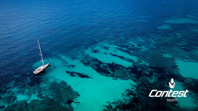
Contest Yachts
"At Contest Yachts, we build yachts for sailors who explore the world: 'Building dreams together'. We believe that exploring also means understanding and caring for the oceans we travel."
Aknostic
"At Aknostic, we believe technology should enable independence and sustainability—values that perfectly align with SeaSense's mission to democratize ocean science."
Help us expand our network of ocean sensors and contribute to vital environmental research.
Individual Donations
Support our mission with a one-time or recurring donation. Every donation helps us deploy more and better sensors.
Donate NowCorporate Sponsorships
Align your brand with ocean conservation and scientific research through sponsorships and partnerships.
Sponsor OpportunitiesGrants & Foundations
We welcome support from foundations and organizations interested in funding environmental research.
Investment OpportunitiesFrequently Asked Questions
Find answers to common questions about Project SeaSense.
Don't see your question here? Contact us
Join the SeaSense Network
Sign up to join our waiting list and be one of the first sailors to receive a sensor unit designed to be easily mounted on your boat.